Casa Sauza · Agave · Mexico

Drones, the new field crew.

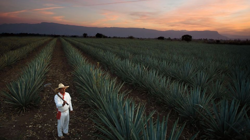
Counting 30 million agave plants by hand, in the heat of Nayarit, was getting harder every year. Manglar trained an AI model to count them from the air.

For Elizabeth Hernández, agave planning manager at Casa Sauza, the first problem drones solved wasn't technical. It was about people. Sauza kept track of its 30 million agave plants with two crews of 20, who walked the fields twice a year counting plant by plant, and fewer and fewer people were willing to take the job. As Hernández puts it:

Es un trabajo muy pesado, hay que imaginarse los 40 grados de calor en Nayarit e ir contando agave por agave, [verificar] que las plantas siguen ahí, que no están dañadas.

It's very hard work: imagine 40 °C heat in Nayarit, counting agave by agave, checking the plants are still there and undamaged.

A drone can fly over a field and photograph it. Telling an agave from a weed or a stone is another matter, and no off-the-shelf tool could. Sauza needed one built for agave.

That's where Manglar came in. The team trained an AI model to recognize blue agave in drone imagery, and Sauza became Manglar's first agave customer. Germán Medina, Manglar's CEO, recalls how it started:

Ya teníamos experiencia con cultivos en Colombia, lo que hicimos [para Sauza] fue construir un modelo de inteligencia artificial para el cultivo del agave. Fue el primer cliente con quien trabajamos en agave.

We already had experience with crops in Colombia; what we did for Sauza was build an AI model for agave. They were our first agave customer.

Counting soon wasn't enough. Weeds cost piña weight at every stage of the six-year cycle, so the models learned to map weedy zones and to flag diseased or pest-hit plants. Those maps now guide drones to apply herbicide only where it's needed, instead of spraying whole fields from backpacks or light aircraft.

Today Sauza counts the agave on 60% of its fields every two months, aiming for 90%. Its engineers see each field in a digital platform the week after it's flown, and plan from there. Hernández gives an example of what her engineers can now say:

Ahora ya sé que en ese cultivo hay maleza, enfermedades, agave marchito… entonces en mi próximo plan semanal voy a incluir la solución de este problema.

Now I know that field has weeds, disease, wilted agave… so I'll put the fix in my next weekly plan.

Because every plant is tracked against yearly targets, Sauza doesn't wait six years to see how a crop turned out: it can already project how its fields will meet tequila demand years ahead. What began as an answer to a labor shortage is now part of how the company plans. As Hernández sums it up:

Los resultados no los veré al final, sino año con año, y eso nos permite tener un plan.

I won't see the results only at the end, but year by year, and that lets us plan.

Based on the article by Zacarías Ramírez in Fortune en Español, April 2020.

Ingenio Providencia · Sugarcane · Colombia

A sweet advantage.

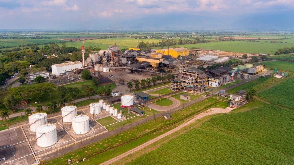
Providencia guides its harvesters with row lines Manglar traces from drone imagery: less stool damage, and operators free to focus on the cut.

In Colombia's Cauca River valley, the climate lets mills plant and harvest cane all year round. But climate isn't what keeps the region competitive: the technology its mills adopt, and the know-how they build with it, are.

A few years ago, Diego Sandoval, director of precision agriculture and GIS at Ingenio Providencia, saw AI for agriculture as something distant. He doubted any company could solve what the mill needed, starting with stool damage during mechanized harvest. As Sandoval tells it:

Toda su parte tecnológica, su capacidad y el equipo humano que hay detrás sí cambiaron mi perspectiva, al entender que sí era algo alcanzable, que estábamos cerca y que sí había una empresa colombiana que podía hacerlo.

Their technology, their capability and the people behind it changed my view: I understood it was within reach, that we were close, and that a Colombian company could do it.

The goal was clear: cut stool damage as much as possible and protect the next ratoon. Manglar traces the cane rows automatically from drone imagery, and those lines now feed the autosteer on Providencia's harvesters.

With the machine steering itself along the rows, there's less stool damage, and operators can focus on the quality of the cut instead of the direction of the harvester. Providencia harvests every day, so the lines are put to the test every day, and the team uses them without complaints. Sandoval puts it plainly:

La precisión del trazado automático de líneas de surco proporcionado por Manglar es muy buena y es algo que se demuestra todos los días.

The precision of Manglar's automatic row-line tracing is very good, and it proves itself every day.

Convincing the mill was simple, Sandoval says. Beyond the cost, a single drone flight brings much more than row lines: detailed information on every block. In Sandoval's words:

No hay comparación en los costos de la metodología que usa Manglar versus otras metodologías.

There's no comparison between the cost of Manglar's methodology and other methodologies.

Today Providencia works with Manglar as a strategic partner: one that keeps pace as the mill's precision agriculture evolves, handles large volumes of data and builds tools to fit. As Sandoval sums it up:

Lo que más nos gusta de Manglar es esa capacidad de adaptación, su mente abierta para escuchar ideas, su equipo técnico y la confianza que nos han generado a través de estos años cuando nos han dicho «Dame tu necesidad, miramos cómo la resolvemos» y sí la han resuelto.

What we like most about Manglar is how it adapts, its openness to ideas, its technical team and the trust built over these years: when they've said “Tell us what you need, we'll work out how to solve it”, they have.

Ingenio Mayagüez · Sugarcane · Colombia

Seeing beyond the obvious.

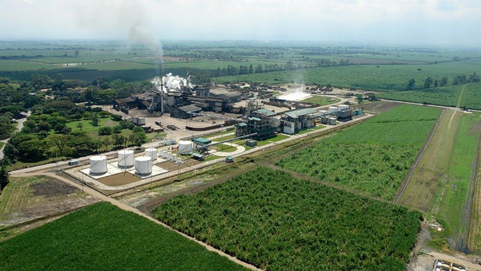
Mayagüez measures the gaps in its cane with Manglar instead of sampling crews, and its field supervisors now ask for the replant maps themselves.

Gaps in the stand, stretches of row with no cane or no regrowth, decide where to replant and how much. Before Manglar, crews measured them by hand and projected a sample over the whole area. It was imprecise: young ratoon shoots are hard to see even walking the field.

In ultra-high-resolution drone imagery, Manglar's models detect even the youngest ratoon shoots and measure the gaps row by row. Catalina Delgado, director of precision agriculture and GIS at Ingenio Mayagüez, had long seen AI as the strategy behind precision agriculture. What was missing was making it concrete. As Delgado puts it:

Manglar lo volvió visible, lo volvió tangible y lo volvió una herramienta para una toma de decisiones acertada y oportuna.

Manglar made it visible, made it tangible and turned it into a tool for sound, timely decisions.

Farming often runs on averages and rules of thumb. Measuring gaps precisely changed that, and with it the way the mill manages its fields. Not without resistance at first: field staff used to counting gaps and seed cane by hand asked why they should change. Delgado doesn't play it down:

La palabra «cambio» siempre genera resistencia, y más en un ámbito como el agrícola.

The word “change” always meets resistance, especially in agriculture.

The answer was data. The team went out, made a careful manual count, and compared it with Manglar's. Delgado describes the result:

Somos un equipo que le cree mucho a la tecnología, pero que le cree validando en campo […] las diferencias entre esa metodología versus la de Manglar fueron inferiores al 3 %.

We're a team that believes in technology, but believes in it by validating it in the field […] the differences between that method and Manglar's were under 3%.

That gave confidence to the mill's own staff and to its cane suppliers, who farm more than 65% of Mayagüez's area, so the mill extended the maps to them too. Today it's the field supervisors who ask for replant maps, to know how much replanting each field needs. As Delgado sums it up:

Van más allá y dan un valor agregado: no es sólo entregar una imagen, no es sólo entregar el total de metros lineales en caña, es generar informes entendibles por el personal en campo.

They go further and add value: it isn't just delivering an image or the total linear meters of cane, it's producing reports the field staff can understand.